GeoTorchAI
A Deep Learning and Scalable Data Processing Framework for Raster and Spatio-Temporal Datasets
GeoTorchAI Modules!
All modules available in GeoTorchAI and the flow of interaction between various components can be summarized with the following diagram:
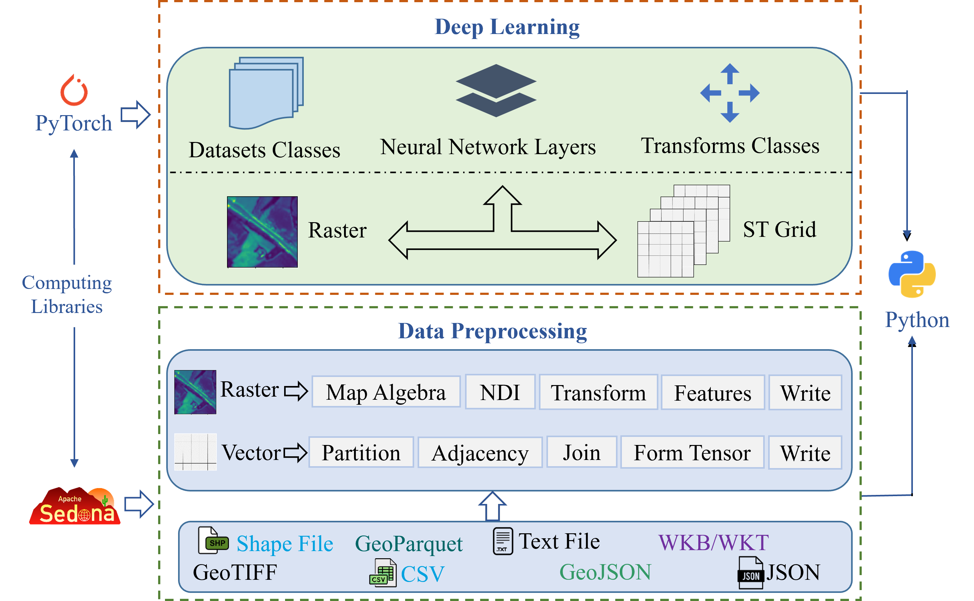
There are two main modules under GeoTorchAI - deep learning module and data preprocessing module. Each of these two modules are again divided into two sub-modules - one for raster imagery datasets and another one for spatiotemporal non-imagery datasets. The deep learning module runs on PyTorch while the data preprocessing module runs on Apache Sedona, a distributed spatial data processing framework. Both modules provide easy-to-use Python API to end users for their development.
The flow of interaction among the components in the deep learning module can be represented with the following figure:
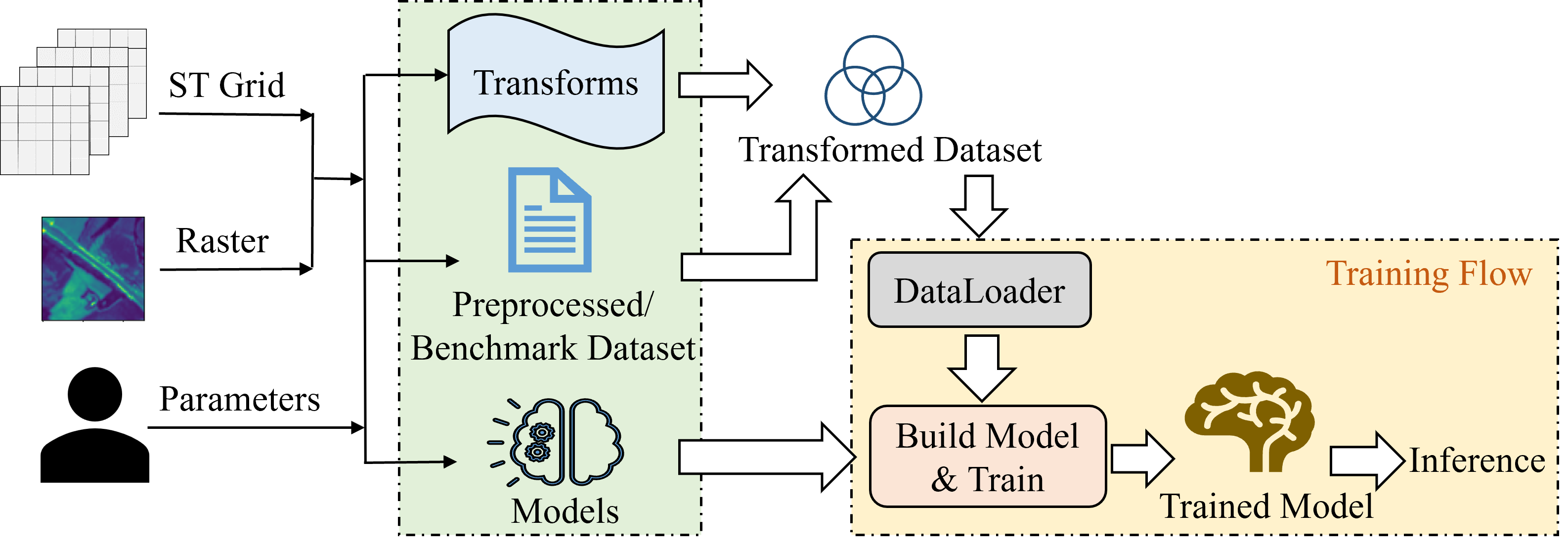
Users can use either import the modules available in the library or prepare their own dataset using the preprocessing module and load it to train a model. There are a lots of pre-built datasets, models, and transformations available to import under the library in both raster imagery and spatiotemporal non-imagery categories.
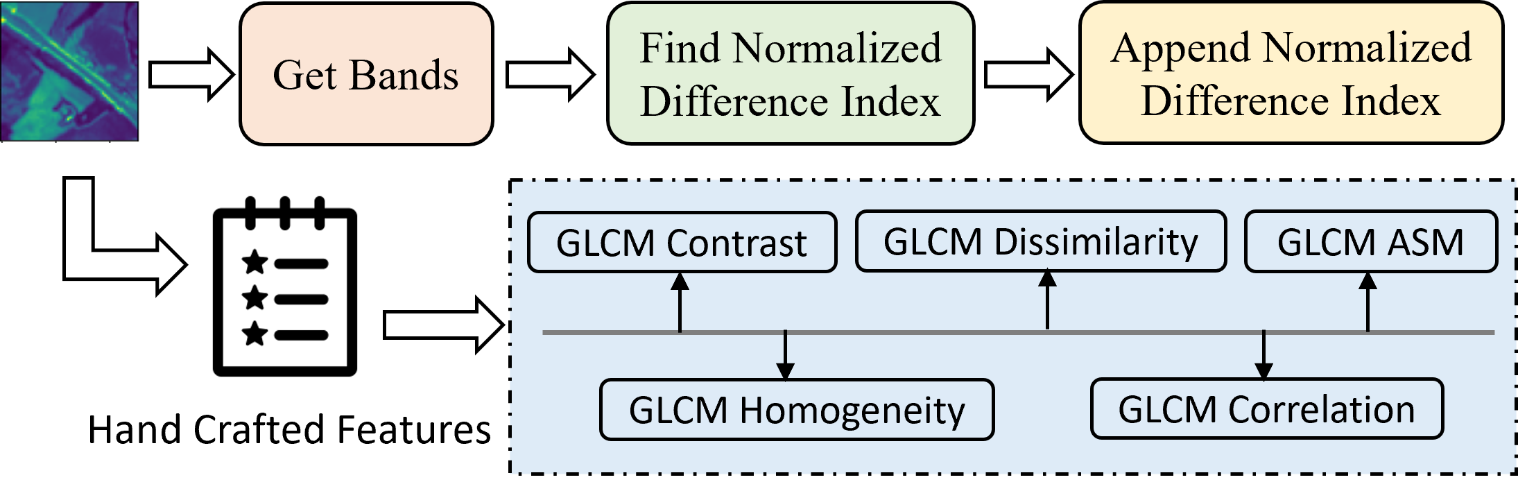
Under the preprocessing module, users have the flexibility of performing two types of data preprocessing - 1) spatiotemporal preprocessing of non-imagery datasets which include preparing a trainable tensor from large raw dataset and 2) raster transformation which includes all tranformations over the raster bands, map algebra operations on the raster bands and getting handcrafted features from raster bands.
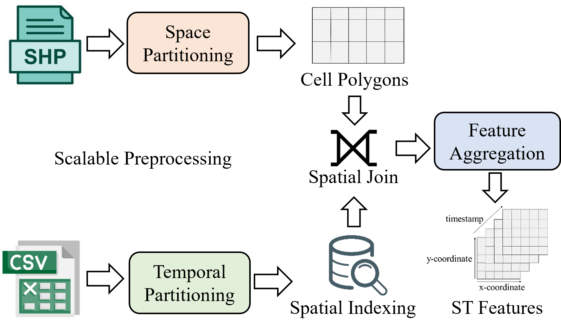
The following figure shows some sample preprocessing steps for spatiotemporal non-imagery datasets.
The following figure shows some sample preprocessing operations for raster imagery datasets.